Places Terminology
Contents
In order to use the Places API, you will need to understand the following concepts used throughout the API documentation.
Places
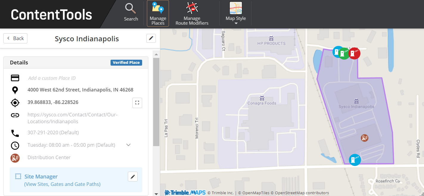
A Place is a collection of data about a location—ranging from mapping location information, such as its name, address and GPS coordinates, to details about its amenities, truck entrances and exits, parking, hours of operation, and more. There are two types of Places:
-
Public Places - These are Places in the Trimble Maps database created by our team of mapping experts and accessible to all users. Public Places include millions of commercial locations across North America that serve the transportation industry, such as distribution centers, intermodal terminals, manufacturing plants, truck stops, and more. You can call information about these Places with the API and use it in routing planning, mobile navigation and back-office operations. You can also customize a Public Place with edits that are private to your account: You can add a custom Place ID, contact information, operating hours and comments. In the ContentTools web tool, public Places are identified with a badge that reads, “Verified.”
-
Custom or Private Places - These are Places you create for your own company and are private to your account. They can include almost all of the same information as public Places—a list of amenities is not currently available—and are used in the same ways.
ContentTools
ContentTools is a web tool where you can create, manage and share location and routing content. It is linked to the same API key you use for the Places API. Any content created with the API is available in ContentTools, and the reverse is also true. ContentTools helps you visualize a Place on the map. For example, using ContentTools is required if you want to add Entry and Exit gates to a Site, gate notes, as well as route paths to those gates. Those features depend heavily on being able to see the road network for proper alignment.

Sites
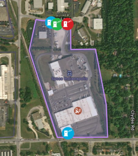
A Site extends a Place to include a boundary geofence around its perimeter, entry and exit points (gates), and other valuable information drivers need to avoid getting lost or wasting time. A Site can encompass one business, such as a shipper’s distribution center. Or, it can encompass multiple businesses, such as an industrial park with warehouses. In that case, the Site itself is the area that contains these businesses under one official name.
A Site might contain multiple public Places. However, Sites drawn on the map around private Places only apply to that specific Place.

Gates and Gate Paths
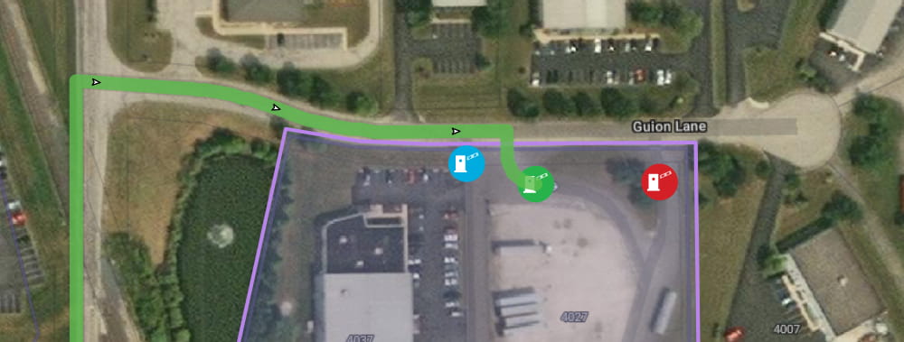
One of the main benefits of using Sites is they allow you to add specific Entry, Exit or Two-Way Gates for Autos or Trucks at a location. In ContentTools, you can even create Entry and Exit Paths to specify which roads you want drivers to take to approach or to depart a Site from as far as five miles away. A Gate Path can provide consistency in first- and last-mile routing for Sites drivers visit regularly.
Note: The routing algorithm in CoPilot and other Trimble Maps applications uses the Gate Path as the preferred route to enter or exit the Site. However, the algorithm may determine there is a better and more cost effective route to a gate that does not follow the Gate Path.

trimblePlaceId and customPlaceId
A trimblePlaceId is assigned to every public Place in the Trimble Maps database as well as every private Place that you create. You can also assign a customPlaceId to any Place, public or private, in addition to the trimblePlaceId. These IDs make it easy to call a location’s information using the Places API.