Single Search Geocoding
Contents
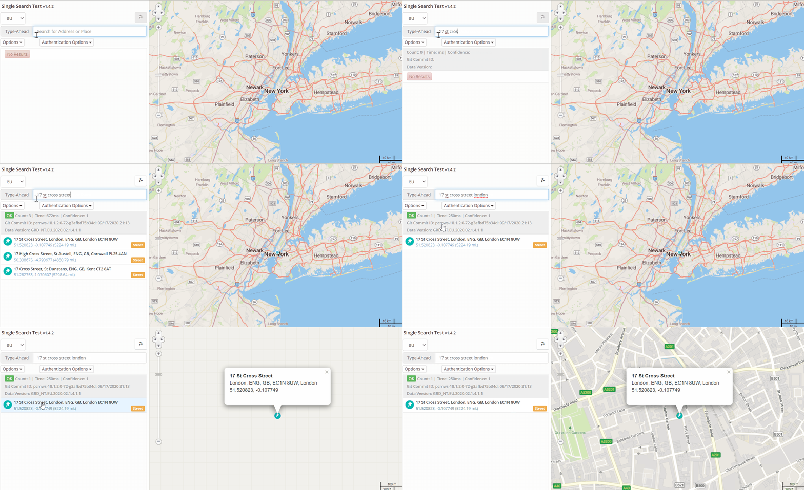
Our Single Search API allows you to geocode or reverse geocode a single string of text, providing a similar user experience to a query on a web search engine. It returns an array of locations that match the search text. It can also help provide more relevant search results by giving you the ability to search based on the user’s current location.
Single Search, our most advanced API for geocoding, is a RESTful service that can be called from any application that requires accurate, up-to-date location data from throughout the world.

How does Search work?
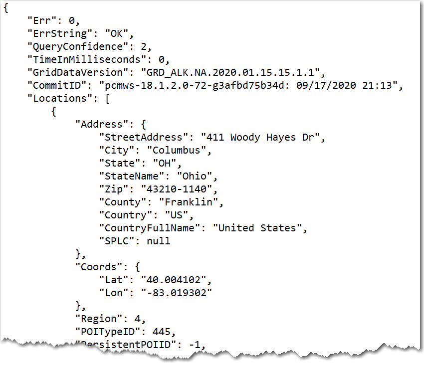
A user can enter as much information as they have about a location and get back an array of possible matches in JSON format. Depending on the parameters included in the search, the JSON returned for each matching location can include:
- A complete address and latitude/longitude coordinates to six decimal places.
- The confidence level of the match - Very High, Good, Uncertain, or Failed. This can help determine whether the user needs to enter more or better information to get a better result.
- Whether the location is a special point of interest for the transportation industry, such as a truck stop, airport, distribution center, etc.
- Road grid and link information in the Trimble Maps database about the location.
- Whether the location has a
TrimblePlaceIdin the Trimble Maps database. This indicates that the location is a critical facility for the transportation industry and that a wealth of additional information is available by calling our Places API.

How can searches be customized?
The Search API includes a wide range of parameters that allow you to filter and customize results. For example, you can set:
- The current latitude/longitude to ensure nearby results are prioritized.
- Whether to only include or exclude matches to certain fields in your results. For example, you might only want to return Custom Places you have created that match the search text, and ignore other things (streets, cities, etc.) with matching names.
- Whether to return additional metadata about the search, including the confidence level, and road and grid link information in the Trimble Maps database.
- Whether to return the
TrimblePlaceId, if one exists.
What is “fielded” search?
Search also supports fielded searches, which help narrow results by using keywords within a search string. The keywords available are: housenumber (or hn), route (or rt), county, city, zip, splc, fullpostcode, fpc, poi, state, and country.
For example, a search for 49 Washington Rd Princeton state:NJ includes the keyword “state.” It forces “NJ” to be interpreted as a state, and it ensures no other term in the string can be interpreted as a state.
What can you do with a TrimblePlaceId?
Trimble Maps maintains a database that includes tens of thousands of commercial locations across North America that serve the transportation industry. These “Places” range from distribution centers and manufacturing facilities to truck stops and rest areas.
A parameter in Single Search can be set to return whether the location has a TrimblePlaceId. If it does, that ID can then be fed into our Places API to return a trove of additional information about the location, including:
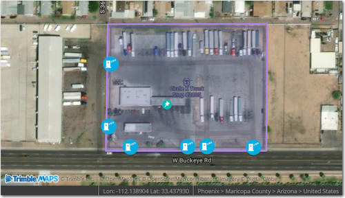
- The details of the Site that surrounds the perimeter of a Place. A Site is a geofence on the map that defines an area such as a warehouse, a shopping mall or a business park. It includes details such as gates where commercial vehicles need to enter or exit.
- The amenities available at the Place, including fuel services, repair services, parking, etc.
- The location’s hours of operation and contact information (phone and web.)
These details can improve mapping of the location, and also provide the details needed for accurate routing—right down to the final mile.

For more information, please see:
Share this article: